Imagine standing atop the majestic Mount Shasta, surrounded by breathtaking views and crisp mountain air. It's a place that beckons adventurers and nature enthusiasts from all over the world. But have you ever wondered what the average temperature is on this formidable peak? From summer hikes to winter ski trips, knowing what to expect in terms of climate can greatly enhance your experience on Mount Shasta. In this article, we will uncover the mysteries of this iconic mountain's average temperatures, revealing the hidden secrets of its ever-changing climate. So get ready to embark on a virtual journey and discover the remarkable temperature patterns of Mount Shasta.

Understanding Mount Shasta's Geographic Location
Where is Mount Shasta located?
Mount Shasta is a majestic volcano located in Siskiyou County, Northern California, in the United States. It is part of the Cascade Range, which stretches from northern California to southern British Columbia in Canada. The volcano is situated about 60 miles south of the Oregon border and stands tall at an impressive elevation of 14,179 feet.
Mount Shasta's altitude
As mentioned earlier, Mount Shasta's impressive altitude of 14,179 feet makes it one of the highest peaks in the Cascade Range. Its towering presence and stunning snow-capped summit are a sight to behold. This significant altitude not only contributes to the mountain's grandeur but also has a profound influence on its climate and average temperature.
Key geographic characteristics of Mount Shasta
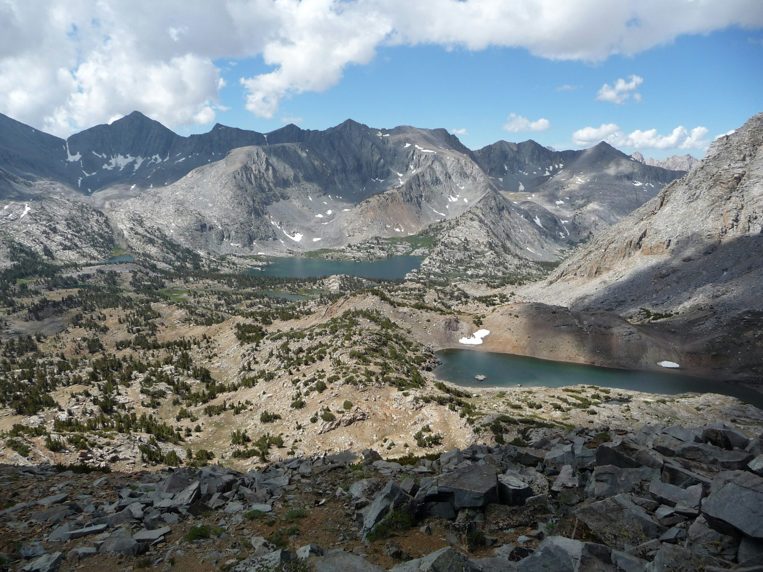
Mount Shasta is a stratovolcano, characterized by its steep and symmetrical shape, formed by numerous layers of hardened volcanic material. Its peak is covered in glaciers, with the largest being the Whitney Glacier. The mountain is surrounded by lush forests, alpine meadows, and beautiful lakes, adding to its scenic beauty. Its geographic location, altitude, and glacial presence all play important roles in shaping the average temperature experienced on Mount Shasta.
Understanding the Concept of Average Temperature
Definition of average temperature
Average temperature refers to the typical or mean temperature observed over a given timeframe, usually a year. It provides a useful summary of the overall temperature patterns experienced in a particular area. In the case of Mount Shasta, determining the average temperature helps scientists and researchers understand the climatic conditions of the region and their impact on the mountain's unique ecosystem.
How average temperatures are calculated
To calculate the average temperature, meteorologists collect temperature data at specific intervals, such as hourly, daily, or monthly measurements, throughout the defined period of analysis. These temperature observations are then averaged, taking into account the time span and the number of data points. This calculation provides a representative value that reflects the general temperature conditions experienced over that specific timeframe.
Factors that affect average temperature
Numerous factors contribute to the variation in average temperatures. Mount Shasta's average temperature is influenced by its geographical location, elevation, prevailing wind patterns, proximity to large water bodies, and the presence of other geographical features. These factors interact in complex ways, ultimately shaping the unique climate of the mountain and affecting the average temperature observed.
Seasonal Changes on Mount Shasta
Average temperature during different seasons on Mount Shasta
Mount Shasta experiences distinct seasonal changes throughout the year, each accompanied by its own average temperature range. In the winter months, temperatures on the mountain can drop well below freezing, with an average of around 20°F to 30°F (-6°C to -1°C). Spring brings a gradual increase in temperature, ranging between 40°F to 60°F (4°C to 15°C). Summers on Mount Shasta are typically mild and pleasant, with average temperatures ranging from 60°F to 80°F (15°C to 27°C). Autumn offers comfortable temperatures ranging from 40°F to 60°F (4°C to 15°C) before transitioning into the colder winter months.
Why seasons on Mount Shasta differ from normal weather patterns
The seasonal changes on Mount Shasta differ from typical weather patterns due to the mountain's geographic location and elevation. Being located in the Cascade Range, Mount Shasta is exposed to the Pacific Ocean's influence, which brings moist air masses and generates weather systems that impact the mountain. Additionally, the high elevation of Mount Shasta results in cooler temperatures compared to the surrounding lower-lying areas, further contributing to the distinct seasonal variations experienced.
How changes in the seasons affect the average temperature on Mount Shasta
As the seasons change, Mount Shasta's average temperature fluctuates accordingly. In winter, when colder air masses prevail, the average temperature drops significantly. This is accompanied by heavy snowfall, which contributes to the mountain's snowy landscape. In contrast, during the summer months, warmer temperatures prevail, melting a large portion of the winter snowpack. This melting snow not only affects the average temperature but also impacts the flow of streams and rivers originating from the mountain.
Temperature Variations at Different Altitudes
How temperature changes with altitude
Temperature changes with altitude due to variations in air pressure and the behavior of the Earth's atmosphere. As we ascend in altitude, the air pressure decreases, causing the air molecules to spread farther apart. This leads to a decrease in temperature since the molecules have less opportunity to collide and transfer heat energy. On Mount Shasta, this phenomenon can be observed, with temperatures dropping significantly as one climbs to higher elevations.
Temperature differences at the base vs. summit of Mount Shasta
The temperature difference between the base and summit of Mount Shasta can be quite substantial. At the base, located at lower elevations, the average temperature is generally higher due to the influence of warmer air masses from the surrounding areas. As one ascends towards the summit, the average temperature decreases due to the decrease in air pressure and the cooling effect of higher elevation. This significant variation in temperature from the base to the summit creates unique microclimates and ecological zones on the mountain.
Critical altitude milestones and their associated temperatures on Mount Shasta
Mount Shasta has several critical altitude milestones, each with its own climatic characteristics and associated temperatures. For example, at an elevation of approximately 7,000 feet (2,134 meters), the average temperature drops significantly, and the landscape transitions from dense forests to alpine meadows. At higher altitudes, such as around 10,000 feet (3,048 meters), the average temperature is even colder, leading to the formation of glaciers and permanent snowfields. These altitude milestones significantly impact the average temperature experienced at different points on Mount Shasta.

Influence of Wind on Temperature at Mount Shasta
How wind affects temperature on Mount Shasta
Wind plays a vital role in shaping the temperature experienced on Mount Shasta. It can either amplify or dampen the perceived temperature by affecting the rate at which heat is transferred from our bodies. Wind can enhance evaporative cooling, making us feel colder, or it can reduce the buildup of warm air near our skin, resulting in a cooling effect. Wind patterns on Mount Shasta are largely influenced by its geographic location and can vary depending on the time of year and the prevailing weather systems.
Average Wind speeds on Mount Shasta
The average wind speeds on Mount Shasta vary depending on the location and time of year. At lower elevations, wind speeds are generally lower compared to the exposed ridges and summits. On the mountain's slopes, average wind speeds can range from 10 to 30 miles per hour (16 to 48 km/h). However, during storms and unfavorable weather conditions, wind speeds can reach much higher velocities, often exceeding 100 miles per hour (160 km/h) or more. These powerful winds have a significant impact on the temperature experienced on Mount Shasta.
The influence of wind chill on perceived temperatures on Mount Shasta
Wind chill, also known as the “feels like” temperature, takes into account the combined effect of temperature and wind speed on our perception of cold. As wind speeds increase, our perceived temperature can be significantly lower than the actual air temperature. This is due to the wind's ability to strip away the heat from our bodies more rapidly, making us feel colder than if there were no wind. Wind chill can have a considerable impact on the hiking and recreational activities on Mount Shasta, and it is essential to take it into account when planning outdoor adventures.
Mount Shasta's Climatic Zones and Their Average Temperatures
Different climatic zones on Mount Shasta
Mount Shasta encompasses various climatic zones, each with its own unique average temperature range. At lower elevations, the mountain experiences a Mediterranean climate, characterized by mild winters and warm summers. As one ascends higher, the climate transitions into a subalpine zone, with cooler temperatures throughout the year. Above the subalpine zone lies the alpine zone, where temperatures are consistently colder, and snow and ice persist even in the warmer months.
Average temperatures in each of these zones
In the lower Mediterranean zone, average temperatures range from 40°F to 80°F (4°C to 27°C) during the year. The subalpine zone experiences average temperatures ranging from 20°F to 60°F (-6°C to 15°C), while the alpine zone experiences even colder temperatures, with averages hovering around 10°F to 40°F (-12°C to 4°C). These distinct climatic zones and their associated average temperatures contribute to Mount Shasta's diverse and unique ecological makeup.
How these zones influence the overall average temperature of Mount Shasta
The presence of different climatic zones on Mount Shasta contributes to the calculation of the overall average temperature. Each zone contributes its set of temperature data, which is then weighted according to its size and importance. The lower Mediterranean zone, being the most extensive and densely populated, has a more significant impact on the overall average temperature compared to the higher alpine zone. The combination of these zones creates a comprehensive understanding of the mountain's temperature patterns.

Comparison of Mount Shasta's Average Temperature with Nearby Areas
Neighboring areas and their climates
Mount Shasta's average temperature can be compared with the average temperatures experienced in the surrounding areas. These include cities and towns such as Weed, Redding, and Ashland, each with its own unique climate. Weed, located at the base of Mount Shasta, experiences similar average temperatures due to its close proximity. Redding, located to the south of Mount Shasta, has a warmer climate overall, while Ashland, situated to the north in Oregon, has a cooler and wetter climate.
How Mount Shasta's average temperature compares with these areas
When comparing Mount Shasta's average temperature with the neighboring areas, it is evident that the mountain's unique geographic features, such as its elevation and proximity to the Pacific Ocean, contribute to lower average temperatures. Weed, being at the mountain's base, experiences temperatures closer to those observed on Mount Shasta. In contrast, areas further away from the mountain, such as Redding and Ashland, experience higher or lower average temperatures due to the influence of other geographical and climatic factors.
Factors causing these differences
The differences in average temperature between Mount Shasta and the neighboring areas can be attributed to various factors. Mount Shasta's elevation plays a significant role in creating cooler temperatures compared to lower-lying areas. The proximity to the Pacific Ocean brings moisture and cooler air masses, influencing the climate on the mountain. Additionally, the surrounding terrain and geographical features can create microclimates, further contributing to variations in average temperatures between Mount Shasta and the neighboring areas.
Implications of Mount Shasta's Average Temperature
Effects on local wildlife
Mount Shasta's average temperature has significant implications for the diverse wildlife species that call the mountain home. The unique ecological zones and temperature ranges support various plant and animal communities. The cooler temperatures at higher elevations provide habitats for cold-adapted species, such as alpine plants and animals, while the lower slopes support a rich diversity of vegetation and wildlife adapted to milder conditions. Changes in the average temperature can disrupt these delicate ecosystems and potentially threaten the survival of certain species.
Effects of changing average temperatures on local ecology
As climate patterns shift and average temperatures change, the local ecology on Mount Shasta can be profoundly impacted. Rising temperatures can lead to the melting of glaciers and diminished snowpack, affecting the availability of water resources for plants and animals that rely on them. This, in turn, can lead to changes in vegetation patterns, disruption of wildlife habitats, and altered food availability. Understanding and monitoring the effects of changing average temperatures is crucial for the conservation and management of Mount Shasta's delicate ecosystem.
Hiking and recreational considerations of Mount Shasta's average temperature
For those seeking to explore and enjoy Mount Shasta's natural wonders, understanding the average temperature is essential for planning hiking trips and other recreational activities. The colder temperatures at higher elevations require appropriate clothing and gear to ensure safety and comfort. It is crucial to be prepared for rapid weather changes, as Mount Shasta's conditions can be unpredictable. Consulting local forecasts, checking conditions, and being mindful of temperature variations can make hiking and recreational experiences on Mount Shasta more enjoyable and safer.
Effects of Global Warming on Mount Shasta's Temperature
Global warming and rising average temperatures
Global warming refers to the long-term increase in the Earth's average temperature due to human activities, primarily the burning of fossil fuels and deforestation, which release greenhouse gases into the atmosphere. This rise in global temperatures has far-reaching consequences for the climate system, including its impact on Mount Shasta's temperature.
Impact of global warming on Mount Shasta's temperature
Global warming has the potential to significantly impact the temperature patterns on Mount Shasta. As average global temperatures increase, Mount Shasta's glaciers and snowpack are expected to shrink, leading to changes in the mountain's overall temperature. These changes can disrupt the fragile balance of ecosystems, affecting wildlife and vegetation. Additionally, altered temperature patterns may impact recreational activities and the availability of water resources on and around the mountain.
Predicted impacts and changes in future temperatures
The precise impacts of global warming on Mount Shasta's temperature are challenging to predict with certainty. However, climate models suggest that future temperatures on the mountain may be higher on average, leading to a reduction in snow and ice cover. This could have far-reaching consequences for the mountain's ecology, local communities, and recreational use. It is crucial for ongoing research and monitoring efforts to understand and address the potential impacts of global warming on Mount Shasta.
Frequently Asked Questions About Mount Shasta's Average Temperature
Common temperature-related inquiries about Mount Shasta
- What is the coldest temperature ever recorded on Mount Shasta?
- Are there any temperature variations throughout the day on the mountain?
- How does the average temperature on Mount Shasta compare to other volcanoes in the Cascade Range?
Misconceptions of Mount Shasta's temperature
- Does Mount Shasta have a consistently cold temperature throughout the year?
- Is Mount Shasta always covered in snow and ice due to its average temperature?
Understanding risk factors related to Mount Shasta's average temperature
- How does temperature affect the risk of avalanches on Mount Shasta?
- Are there any particular precautions to take when hiking Mount Shasta based on the average temperature?
- Can extreme temperatures on Mount Shasta be life-threatening?
By understanding Mount Shasta's geographic location, the concept of average temperature, seasonal changes, temperature variations at different altitudes, the influence of wind on temperature, the mountain's climatic zones, comparisons with nearby areas, implications of average temperature, the impact of global warming, and addressing common questions and misconceptions, we can gain a comprehensive understanding of Mount Shasta's average temperature and its broader significance.
