?Have you ever considered standing on the shoulder of a volcano while convincing yourself that the bag of trail mix in your pack will somehow transform into a gourmet meal?
Mount Shasta's Legendary Hiking Trails
Mount Shasta has a way of making you feel simultaneously humbled and oddly competitive with your own footwear. You’ll find jagged glaciers, ancient forests, and an abundance of hiking options that range from polite day rambles to summit attempts that demand glacier skills and a stubborn refusal to admit defeat. This guide will walk you through the mountain’s most celebrated trails, safety considerations, gear, and the sort of tiny humiliations that will become your favorite hiking story.
Why Mount Shasta matters to hikers
You’ll notice that Mount Shasta isn’t only a mountain; it’s a character in people’s lives. It’s where locals set morning coffee mugs on windowsills to watch the sun paint the slopes, where climbers return year after year, and where you may unexpectedly meet someone who insists that the peak whispered to them at dawn. For hikers, the mountain offers dramatic vertical relief, varied ecosystems, and the kind of solitude that makes phone batteries feel ashamed.
A short note on myth and reality
There’s mythology surrounding Mount Shasta — spiritual retreats, New Age legends, and odd postcards of people who look serenely enlightened in fleece jackets. You don’t have to buy into any of it to appreciate the place, but you should be prepared for the possibility of hearing a story about a sasquatch substitute while stopped at a trailhead. Either way, the mountain remains spectacularly real.
Planning your visit
Planning is where ambition meets responsibility. If you wander onto Mount Shasta without a plan, the mountain will not be offended; it will be efficient.
When to go
Your season choices shape everything from trail conditions to the number of people who will judge your crampon technique. Summer (July–September) is the most popular time for non-technical hikes and summit attempts when weather is more stable and snowfields are smaller. Spring and early summer bring heavy snowpack and avalanche risk, which may turn a “hike” into a snow expedition that requires technical gear. Winter is for experienced mountaineers.
Permits and regulations
You’ll want to check current requirements with the Shasta-Trinity National Forest before arrival. Wilderness permits are typically required for overnight stays in the Mount Shasta Wilderness, and there are registration protocols for summit attempts that help search-and-rescue teams if you make an unfortunate decision about crampons. The rules change, and that’s their hobby.
Getting there and parking
Access points vary by trail. The Bunny Flat trailhead on the south side is among the most used for summit attempts and offers parking (often leaving you negotiating for a spot like you’re late to a wedding). Castle Lake, McCloud Falls, and Clear Creek trailheads are reached by forest roads and have parking that fills early on summer weekends. Always follow posted signs—“No Parking” means the rangers judged your parking sense already.
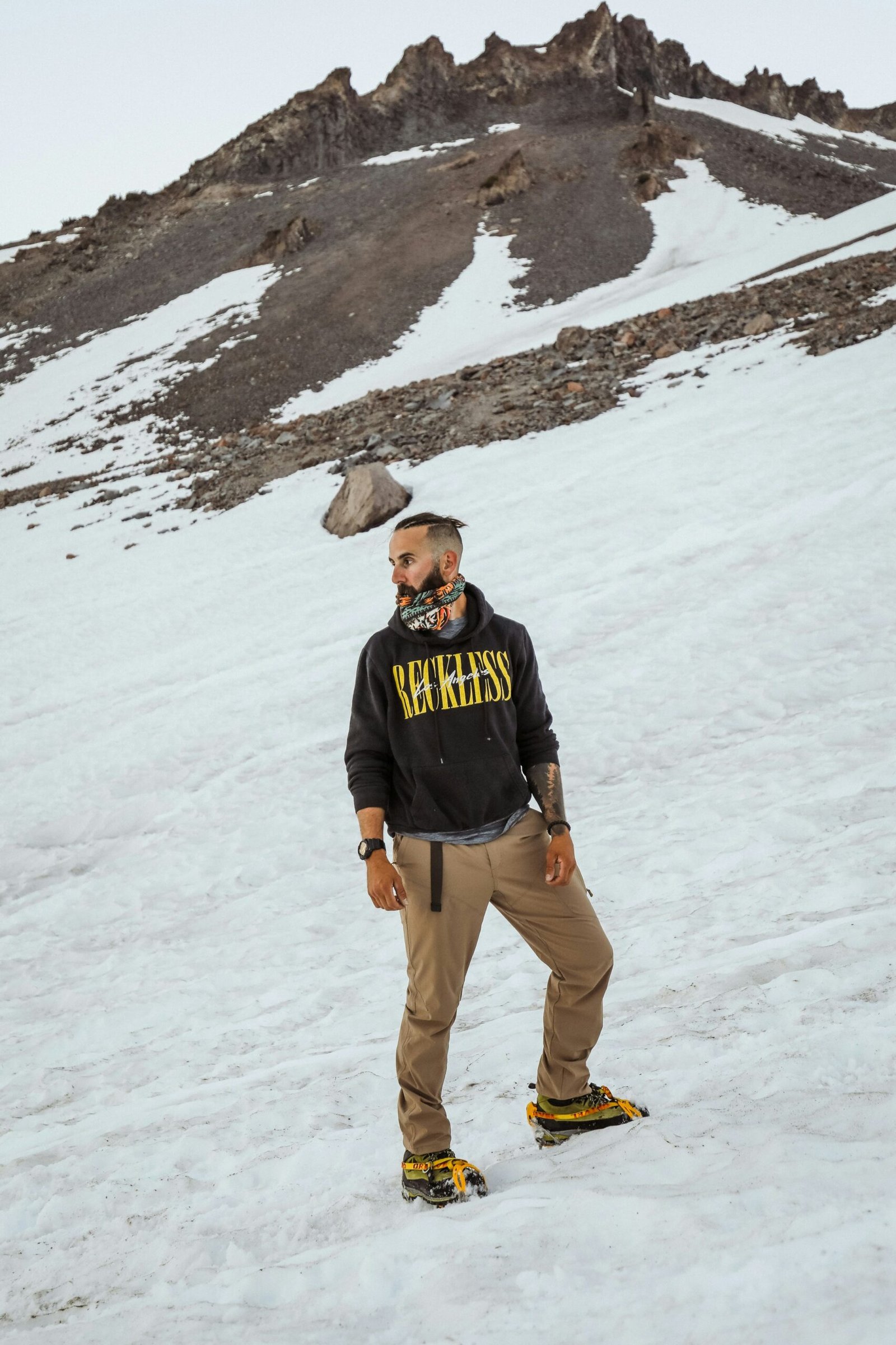
This image is property of images.unsplash.com.
Safety and preparation
Pretending you’re prepared doesn’t count. Preparation is real.
Weather and altitude
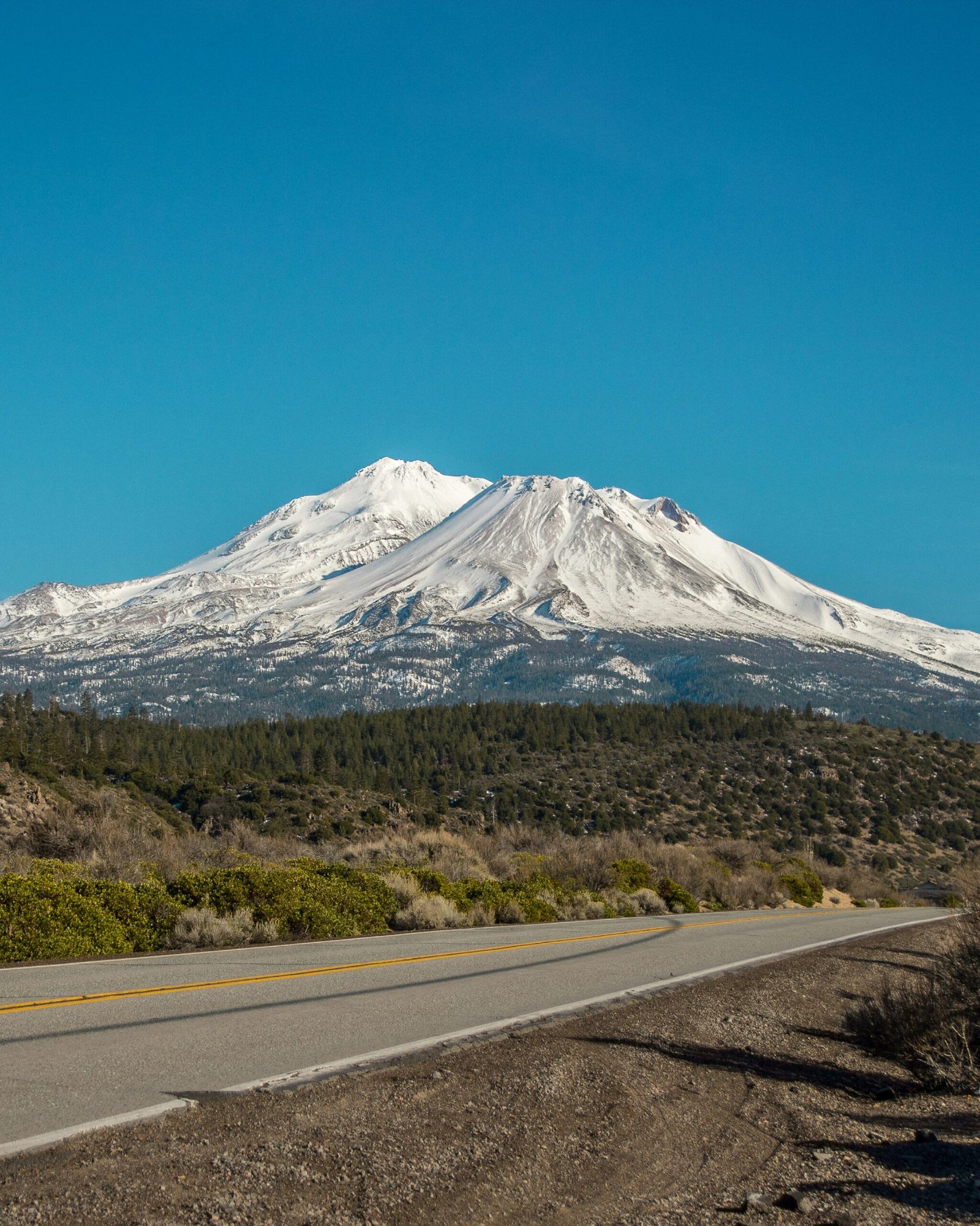
Mount Shasta’s elevation (14,179 ft / 4,322 m) creates fast-changing weather. You’ll see sun, wind, clouds, and snow sometimes within the same hour. Altitude sickness is a genuine concern; even the strongest coffee won’t compensate for thin air. Give yourself time to acclimatize, understand the symptoms (headache, nausea, disorientation), and be ready to turn around.
Route finding and navigation
Trails can vanish into scree, snowfields, or the part of the forest that looks suspiciously like the set of a low-budget thriller. Carry a map, compass, GPS, and the humility to use them. On glaciers you’ll need route-finding skills and the ability to recognize crevasse-prone terrain.
Wildlife, plants, and etiquette
There are black bears, deer, marmots, and an ecosystem that reacts badly to garbage. You’ll want to pack out everything, avoid feeding wildlife, and store food appropriately if you camp overnight. Also remember that some meadows and special areas are ecologically sensitive — walk on durable surfaces and stay on trails.
Leave No Trace and cultural respect
The mountain has spiritual significance for many Native peoples. Maintaining respect for sacred sites, following Leave No Trace principles, and reading posted signs is both courteous and smart. If someone tells you a location is special and asks you to behave, you behave.
Top trails and routes
Choosing a trail depends on your abilities, ambitions, and willingness to admit you forgot sunscreen. Below is a helpful table summarizing key routes, followed by detailed descriptions so you can pretend you planned each step intentionally.
| Trail / Route | Round-Trip Distance (approx.) | Elevation Gain (approx.) | Difficulty | Best Season | Trailhead |
|---|---|---|---|---|---|
| Bunny Flat → Avalanche Gulch (Standard Summit) | 12–18 miles | ~7,000 ft | Very strenuous, technical (winter/spring) | July–Sep (summer) | Bunny Flat |
| Hotlum-Bolam (North/Northeast Summit Route) | 12–18 miles | ~7,000 ft | Very strenuous, glacier travel | July–Sep | Northside / Ski Bowl area |
| Shastina (satellite cone) | 8–12 miles | ~5,000–6,000 ft | Strenuous, less technical | July–Sep | Clear Creek / Shastina access |
| Castle Lake Trail | 2–5 miles | ~600–1,000 ft | Easy–moderate | Year-round (depending on snow) | Castle Lake Trailhead |
| McCloud Falls (Lower/Middle/Upper) | 2–6 miles combined | Minimal | Easy | Spring–Fall | McCloud River Historic area |
| Gray Butte/Gray Butte Lookout area | 6–10 miles | 1,000–2,000 ft | Moderate | Summer–Fall | Gray Butte trailheads |
All numbers are approximate. You’ll want to double-check recent trail conditions and map data.
Avalanche Gulch — The standard summit route (from Bunny Flat)
This is the route most people mean when they say “summit Mount Shasta.” You start at Bunny Flat, ascend to Horse Camp, and continue up Avalanche Gulch to the summit ridge. You’ll cross scree, snowfields, and perhaps the odd person wearing more confidence than crampons.
The route requires glacier travel skills in many conditions, and you’ll likely need an ice axe, crampons, and ropes in the spring and early summer. You’ll gain roughly 7,000 feet of elevation, and a typical round-trip can be a very long, very committed day — or a comfortable overnight with a bivy. Many climbers break the trip into two days, camping at Horse Camp or near the base of the gulch.
Hazards: rockfall, cornices, crevasses in heavy snow years, and altitude. If you’re unfamiliar, hire a guide.
Hotlum-Bolam — The north face approach
The Hotlum-Bolam route climbs the glaciers on the mountain’s northeast side. It’s less traveled than Avalanche Gulch and offers splendid glacier scenery and views of the hotlum glacier. Because it deals with glacier travel, you’ll need solid crampon and ice-ax skills and a willingness to manage rope teams if conditions require.
The approach is often longer and colder than the south-side routes, but it rewards you with fewer people and a sense of doing something slightly dramatic. Shastina, the satellite cone, may be part of the experience if you’re interested in an extra summit and the ego boost that goes with it.
Shastina — The smaller sibling
Shastina is the 12,270-foot volcanic cone on Mount Shasta’s western flank. It’s a serious hike but less technical than the full summit, with significant exposure and loose rock. The views from Shastina are direct, immediate vistas of Mount Shasta’s summit and are worth the effort if you want dramatic photos without the glacier obligations.
Shastina is sometimes climbed as an add-on during a longer ascent of Mount Shasta, or as a distinct objective for a strenuous day hike.
Castle Lake Trail — A gentle alpine escape
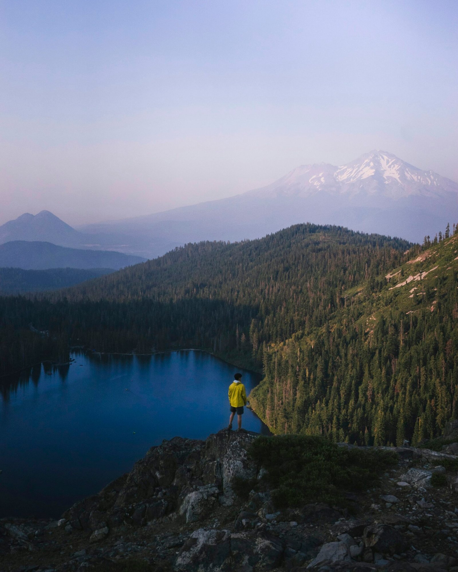
If you want a day of lake-side serenity that might include someone playing a tiny acoustic guitar under a fir tree, Castle Lake is your place. The trail to Castle Lake is moderate, fairly short, and gives you postcard views of Mount Shasta reflected in cold water. You’ll see wildflowers in summer and possibly a moody cloud show in late afternoon.
Castle Lake is popular for swimming (if you’re the sort who believes in freezing water as a wellness practice), short naps, and dramatic sunsets. Leave no trace and avoid the temptation to create cairn cities for Instagram.
McCloud Falls — Water and charm
The McCloud River cascades through three waterfalls — Lower, Middle, and Upper — and the network of short trails linking them is an excellent afternoon diversion if you’re staying in the area. These are easy trails with delights like red-banded volcanic rock, cool river air, and the sound of water that makes city noise feel like a distant sin.
These trails are accessible, family-friendly, and a nice break from altitude planning. You’ll find picnic spots and interpretive signs; you’ll also learn how strangely satisfying it is to lace up shoes for the express purpose of looking at a waterfall.
Gray Butte — Ridge walking and wildflowers
Gray Butte offers panoramic views and a chance to hike through slopes that bloom with spring and summer wildflowers. The trail climbs gradually, giving you plenty of time to practice your rhythm and your internal monologue about why you paid for breathable pants.
This is a good hike for acclimatizing or for a day when you want elevation without glacier ice. The ridgeline views of Mount Shasta and surrounding peaks are excellent for photographers and people who like to point at landscapes and say things like “See? Nature.”
This image is property of images.unsplash.com.
Gear checklist
You’ll regret forgetting one of the essentials, and you’ll also laugh about the sock you accidentally wore inside out. Here’s a practical checklist in table form so you don’t have to pretend you’ll remember everything.
| Item | Purpose | Notes |
|---|---|---|
| Hiking boots | Traction and ankle support | Broken-in, waterproof preferred |
| Daypack (or overnight pack) | Carrying gear | 20–50 L depending on trip length |
| Layers (base, insulating, waterproof) | Temperature regulation | Temperatures change quickly |
| Crampons | Traction on ice | Fit your boots; practice first |
| Ice axe | Self-arrest on snow slopes | Learn how to use it before you need it |
| Helmet | Protection on steep routes | Useful on rockfall-prone routes |
| Rope & glacier travel gear | Crevasse rescue and team travel | Required for steep glacier routes |
| Map & compass/GPS | Navigation | Don’t rely solely on phone signal |
| Sun protection | Sunglasses, sunscreen, lip balm | UV is fierce at altitude |
| Headlamp & batteries | Night travel | Bring extra batteries |
| First-aid kit | Emergency care | Include blister treatment |
| Water + water filter | Hydration | Melt snow or filter natural sources |
| Food | Energy on trail | High-calorie, easy-to-eat items |
| Emergency bivy/space blanket | Shelter | Lightweight but vital |
| Permits/registration | Legal & safety | Photocopies or screenshots of permits |
If you’re attempting the summit, add technical gear like prusiks, harnesses, pickets, and an extra measure of humility.
Navigation and route tips
You’ll find that maps and actual trails sometimes disagree in ways that are philosophically interesting. Hazardous sections are often obvious in hindsight, and GPS batteries have poor survival instincts.
Using landmarks and time estimates
On Mount Shasta, landmarks like Horse Camp, the tree line, and major glacial features help you judge progress. Time estimates are just that—estimates. If you plan a 10-hour day, pack for an 18-hour story you’ll tell around a fire later.
Communication and emergency plans
Cell coverage is inconsistent. Consider carrying a satellite communicator or PLB (Personal Locator Beacon) if you go above tree line or far from popular routes. Tell someone your plan and a realistic turnaround time. If you’re the sort of person who believes “I’ll be fine” is a plan, you are not alone — but have backup.
This image is property of images.unsplash.com.
Itineraries for different hikers
You’ll have preferences: ambitious, leisurely, or stubbornly mythical. Here are three sample itineraries.
Day hike: Castle Lake and Sunset View
- Morning: Hike to Castle Lake (2–4 miles round trip depending on your chosen viewpoint).
- Afternoon: Picnic and short nap; walk part of the lakeshore.
- Evening: Drive to a viewpoint near the town of Mount Shasta for sunset photos.
This fits if you want alpine tranquility without crampons.
Weekend summit attempt (two-day)
- Day 1: Drive to Bunny Flat, hike to Horse Camp and set up a high camp. Accustom your lungs to the altitude.
- Day 2: Summit pre-dawn to avoid afternoon weather, descend to Bunny Flat.
This itinerary gives you rest, acclimatization, and a cold breakfast. It’s the most realistic way to succeed without panicking about oxygen bars.
Multi-day circuit: Shastina + surrounding ridges
- Day 1: Hike to Shastina and camp on the flank.
- Day 2: Traverse nearby ridges, incorporate Gray Butte.
- Day 3: Return, stopping at McCloud Falls.
This is for people who like variety and the possibility of meeting hikers who make interpretive comments about clouds.
Local services, guides, and support
There are professional guides who lead summit attempts if your confidence in survival tools is more academic than practical. Guides supply crampons, rope systems, and the ability to tell you where to step in a calm voice that camouflages panic. Local outfitters also rent gear and offer shuttle services.
If your taste runs to civilization at the end of the day, Mount Shasta city has lodging, cafes, and the sort of small-town bakeries that will memorialize your hike with a pastry.
Environmental considerations
You’ll be walking through fragile alpine tundra and volcanic soils. The mountain’s ecosystems recover slowly. Stay on trails, camp at established sites if possible, and avoid disturbing natural features. If you see old graffiti or vegetation damage, you’ll feel like performing restorative gardening more than you expected.
Photography and observation tips
Mount Shasta’s light is dramatic. Sunrise and sunset create color shows that make you believe your camera is being rewarded for suffering. If you’re shooting wildlife, use long lenses and patience; if you want landscapes, include a foreground subject like a wildflower or cairn to give scale. Bring a lens cloth — dusty volcanic air is excellent at making lenses cry.
Common problems and fixes
You’ll be inventive with solutions in the field. Here are a few common issues and sensible responses.
- Blisters: Stop, drain properly, dress, and tape. Keep walking if comfortable.
- Lost trail: Backtrack to a known point or use GPS/compass; don’t keep bushwhacking.
- Sudden weather: Put on extra layers, seek lower elevation, and if lightning is present, avoid ridgelines and exposed rock.
- Altitude sickness: Descend immediately if symptoms worsen; rest and hydrate for mild cases.
Stories you’ll tell
You’ll gain small triumphs and anecdotal relics: the time you reached a false summit, the friend who forgot gloves but insisted on narrating the descent like a radio host, a marmot who mockingly stole a chip. These will annoy you at the moment and become the material that convinces later acquaintances of your adventurousness.
Responsible hiking and community
You’ll benefit from the mountain’s community—volunteer trail crews, local rangers, and regional rescue teams. Consider volunteering for trail maintenance or donating to local groups that preserve the wilderness. The mountain is nicer when you and your fellow humans agree not to be terrible visitors.
Final notes and resources
If you remember one thing, remember to check current conditions before leaving: weather forecasts, snow reports, and ranger office advisories. If you remember two things, bring a map and someone to laugh with when your plans become pleasantly complicated.
For official information, contact:
- Shasta-Trinity National Forest (official website and ranger stations)
- Local guide services listed in the Mount Shasta visitor directories
- Updated trail condition reports on regional hiking forums and official forest notices
You’ll find Mount Shasta forgiving in its beauty, relentless in its terrain, and oddly generous with stories. Prepare well, respect the mountain, and bring snacks you genuinely like. The mountain doesn’t care about your plans, but it will reward good judgment and a willingness to laugh at the absurdity of attempting to conquer something that’s been standing here longer than your pride.
