Have you ever stood at the base of a mountain and felt the odd mixture of awe, resentment, and the desperate hope that your hiking boots were purchased in the last decade?
This image is property of images.unsplash.com.
Exploring Mount Shasta's Legendary Hiking Trails
If you arrive with a sense of humility and slightly questionable optimism, Mount Shasta will be glad to receive you. The mountain doesn’t applaud, but it does offer trails that swing from mildly pleasant strolls beneath pine-scented skies to high-alpine routes that make you wonder what you were thinking when you carbo-loaded on potato chips. This guide treats you like the perceptive but occasionally foolish person you are — the one who reads checklists but still manages to forget socks.
Below you’ll find practical route descriptions, planning advice, safety considerations, cultural context, gear lists, suggested itineraries, and little observational snorts that you might find entertaining. The aim is for you to move through information like a careful hiker moves through loose talus: with attention, a plan, and a prayer.
Why Mount Shasta?
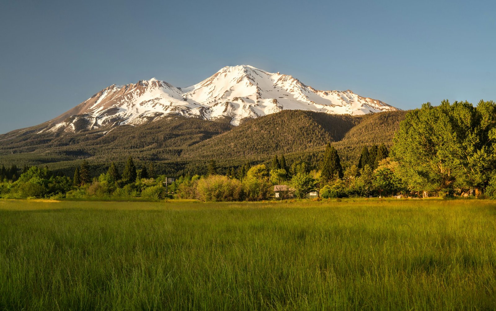
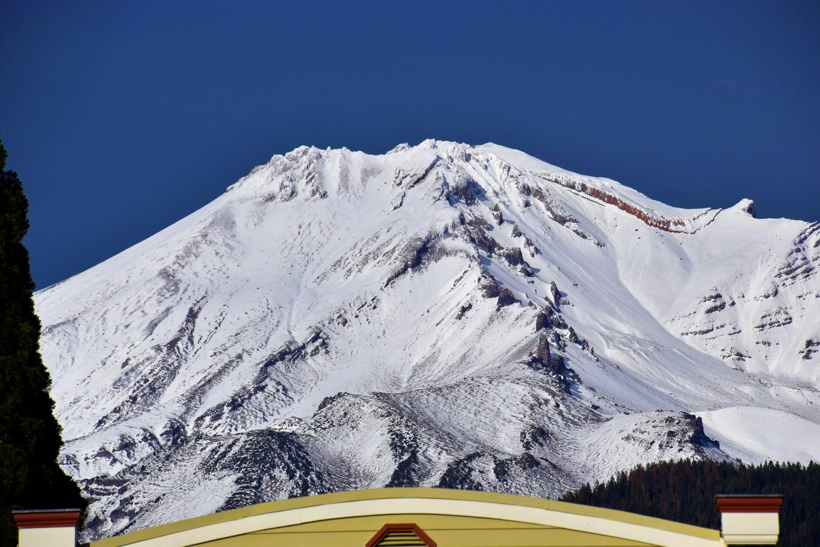
Mount Shasta rises abruptly from the volcanic mosaic of northern California, a symmetrical cone in many photographs and a messy, glacier-scarred reality when you get close. You’re drawn here for more than elevation. You’re drawn by scenery, by the challenge, and, if you’ve read late-night message boards, by the strange cargo of spiritual legend that surrounds the peak. The mountain matters to local indigenous peoples and to those who come for adventure, and the trails give you access to both story and high country.
Getting There and Where to Start
You’ll most commonly approach Mount Shasta via Interstate 5. The town of Mount Shasta (the community) serves as the logistical hub — think gas, last-minute gear, and the sort of diners where the coffee is essential and the pie is a cultural ceremony.
Primary trailheads and access points:
- Bunny Flat: The busiest trailhead, staffed seasonally, and the usual launching pad for the standard climbing routes and day hikes to nearby lakes.
- Panther Meadow and Sisson: Access for south and west side approaches.
- McCloud River / McCloud Falls: Good for connecting hikes around the mountain’s flanks and for scenic side trips.
Always check current road and trail conditions before you go. Snow lingers late on Shasta, and high-clearance or four-wheel-drive may be necessary for some approaches early in the season.
When to Go
You’ll find different Mount Shasta personalities depending on the month.
- Late spring (May–June): Snowpack is often heavy. Routes are snowy and glaciated; you need crampons and an axe. The mountain is quiet but demands respect.
- Summer (July–September): The most popular window. Trails are generally clear at lower elevations; higher routes still have snow in early July. Expect other hikers and a busy Bunny Flat.
- Fall (October–November): Cooler, fewer people, unpredictable weather. Snow can return early.
- Winter (December–April): Serious snow travel. Avalanche danger, extreme conditions, and the need for alpine skills.
You should choose your timing based on the route you want. If you’re aiming for the classic non-technical hikes around the base, late summer is forgiving. If you want a summit attempt via snow and ice, accept that you must also accept the mountain’s power, and plan accordingly.
This image is property of images.unsplash.com.
Permits, Regulations, and Conservation
You are required to follow federal regulations when you’re in the Shasta-Trinity National Forest and in Mount Shasta Wilderness areas. Here’s a short table to make this less of a guessing game:
| Purpose | Permit/Requirement | Notes |
|---|---|---|
| Day hiking in wilderness | No permit typically required | Follow Leave No Trace; check local restrictions |
| Overnight stays in wilderness | Wilderness permit or registration | Obtain from Shasta-Trinity NF ranger station or online as required |
| Climbing to summit (standard routes) | Climber registration strongly encouraged/required seasonally | Register at Bunny Flat registration box or online; requirement varies seasonally — check ranger station |
| Commercial guiding | Commercial use permit | Obtain through forest service and use certified guides for technical climbs |
| Campfires | Subject to seasonal restrictions | Use stoves when fires are banned; many high camps prohibit fires |
Always confirm current rules with the Shasta-Trinity National Forest office before you travel. Regulations change. It’s not personal; it’s bureaucracy doing its job.
Cultural and Mythic Context
You’ll be hard-pressed to avoid the mountain’s reputation as sacred. Local native groups — including the Winnemem Wintu and other tribes — regard Shasta with traditional reverence; ceremonies and history tie the land to identity and story. Outside of those deep cultural threads, New Age narratives have layered more stories on the mountain: myths of underground cities, extraterrestrial visitors, spiritual energy hubs. Treat those as you would roadside lore: intriguing, occasionally kitschy, and not a substitute for local cultural knowledge.
When you visit, do so respectfully. If you encounter ceremonial sites, yield. If you meet elders or tribal community members, listen.
This image is property of images.unsplash.com.
Trail Summaries: Hikes and Routes Around Mount Shasta
You need variety. Here’s a table of some of the more commonly referenced trails and climbing approaches, kept intentionally practical. Distances and elevation gains are approximate; conditions vary.
| Trail / Route | Trailhead | Distance (round trip) | Elevation Gain | Difficulty | Season | Highlights |
|---|---|---|---|---|---|---|
| Bunny Flat to Helen Lake | Bunny Flat | 6–8 miles | ~1,200–1,700 ft | Moderate | Jul–Sep | Subalpine meadows, wildflowers, reflective lake |
| Gray Butte Trail | South Hwy 89 / Gray Butte TH | 4–7 miles | ~1,000–1,500 ft | Moderate | Year-round (watch snow) | Panoramic views of Shasta and valley |
| Avalanche Gulch (standard climb) | Bunny Flat | 10–12+ miles | ~6,800 ft to summit | Challenging/Alpine | Jun–Sep (snow dependent) | Classic climb, glacier travel, steep final slopes |
| Hotlum-Bolam (north side) | Little Shasta TH or other north approaches | 12+ miles | High | Technical/Alpine | Mid-summer | Glacier travel, north face glaciers |
| Clear Creek/Sisson Routes (south) | Sisson Meadows | Variable | Variable | Moderate to strenuous | Summer | Forested approaches, quieter trailheads |
| McCloud River Trails (nearby) | McCloud Falls area | 2–12 miles | Varies | Easy–Moderate | Spring–Fall | Waterfalls, river hiking, lower elevation |
Notes:
- The Avalanche Gulch route is often the “standard” climbing route but is still technical when snow and ice are present. It requires proper alpine gear and experience.
- Gray Butte and Bunny Flat-to-Helen-Lake are excellent day-hike options that give you alpine scenery without committing to a summit.
- If you’re unsure whether a route is hiking or mountaineering, assume the latter until you verify. The mountain seduces you with gentility and then introduces unexpected steepness.
The Classic Day Hikes
You might prefer a day out — no tent, no complex maps, just a sandwich that tastes better on a rock. Two favorites:
-
Bunny Flat to Helen Lake
- Why you go: It’s scenic, achievable, and the alpine lake is satisfying.
- What to expect: Rolling ascent through meadows, seasonal wildflowers, and a relatively gentle elevation gain compared to summit routes.
- Time: 4–7 hours round trip depending on how long you linger by the lake.
-
Gray Butte Loop
- Why you go: Stellar vistas and fewer people if you start early.
- What to expect: Clear ridge lines and a compact loop that rewards you with panoramic Shasta views.
- Time: 2–5 hours depending on your pace and side trips.
If You’re Thinking About the Summit
If you’re considering a summit attempt, pause. Then read everything below.
The most common summit route from Bunny Flat is Avalanche Gulch. It’s often marketed as “non-technical” in dry late summer conditions, but that does not mean easy. You will gain several thousand feet and encounter scree, snowfields, and potential glacier travel. Many rescues happen to people who underestimated the mountain.
Key suggestions:
- Train for elevation and sustained exertion.
- Bring crampons, an ice axe, helmet, and rope if conditions require — and know how to use them.
- Go with a guide if you lack alpine experience.
- Start very early; summit attempts commonly begin pre-dawn to avoid afternoon weather and heat-softened snow.
- Check objective hazards: cornices, crevasses on glaciers, and rockfall.
Gear Checklist
You will love efficient lists because they let you feel accomplished before the hike begins. Below is a practical gear table for different trip types.
| Item | Day Hike | Overnight | Summit/Alpine |
|---|---|---|---|
| Daypack | ✓ | ✓ | Daypack + 40–50L for technical gear |
| Water (2–3L) | ✓ | ✓ | ✓ (plus purification) |
| Food / Snacks | ✓ | ✓ | ✓ high-calorie |
| Layers (base/mid/shell) | ✓ | ✓ | ✓ (insulating down + shell) |
| Headlamp | ✓ | ✓ | ✓ |
| Map & compass / GPS | ✓ | ✓ | ✓ |
| Crampons | ✓ | ||
| Ice axe | ✓ | ||
| Helmet | ✓ | ||
| Rope & protection | ✓ (if required) | ||
| Tent/sleep system | ✓ | ✓ | |
| Stove & fuel | ✓ | ✓ | |
| First aid kit | ✓ | ✓ | ✓ |
| Sunscreen / sunglasses | ✓ | ✓ | ✓ |
| Trekking poles | ✓ | ✓ | ✓ |
| Bear canister or food bag | ✓ | ✓ |
If you’re new to alpine equipment, the correct move is to rent gear and practice with it on easier terrain. The wrong move is to buy crampons and assume they will be intuitive.
Navigation and Communication
Paper maps and a compass are mandatory backups. Signal can be absurdly intermittent. Cell service is usually available in town and sometimes at Bunny Flat, but don’t count on it higher on the mountain. Consider the following:
- Carry a satellite communicator or personal locator beacon for true emergencies.
- Tell someone your plan, route, and expected return time. If you’re vague, a lot of people will assume you meant “whenever” and be very casual about search parties.
- Use route descriptions and topographic maps. If the trail fades, stop and find the route on your map or GPS.
Safety: Hazards You Must Not Treat Lightly
Mount Shasta bargains in extremes: lightning, sudden weather, rockfall, snowfields, glaciers, and altitude. Common mistakes include poor timing (starting too late in the day), underestimating snow and glacier travel, and ignoring signs of altitude illness.
Recognize these warning signs:
- Shortness of breath disproportionate to exertion.
- Confusion, nausea, headache — early altitude sickness.
- Unstable snowpack or cracking noises.
- Dark, persistent clouds building in the afternoon.
If you notice these, don’t negotiate with your body: retreat and reassess. Turning back is not defeat; it’s a strategic victory.
Wilderness Etiquette and Leave No Trace
You’re sharing a fragile environment. A few practical ethics:
- Pack out all trash — including orange peels and Band-Aids.
- Use existing campsites when available.
- Dispose of waste properly (cat holes 6–8 inches deep, 200 feet from water).
- Respect other users and quiet early mornings.
- Keep dogs leashed where required and clean up after them.
If you leave the mountain in better condition than you found it, you’ve done your part. If you leave gear mired in mud because you were “saving it for next time,” you are not helping.
Emergency Procedures
You probably won’t need a dramatic rescue, and that’s reasonable. But prepare for the possibility anyway:
- If someone is injured and stuck, contact emergency services via satellite communicator or phone where possible.
- Stabilize wounds, shelter from wind, and keep the injured warm.
- Use signaling devices — whistle, mirror, bright clothing.
- If lost, stop, stay put (unless danger or you can move to better visibility), and try to retrace your route only if you’re confident.
Search and rescue teams are skilled and expensive; avoid putting yourself in a situation that requires them because of poor judgment.
Suggested Itineraries
Here are a few sample plans depending on what you want.
-
Weekend — Casual alpine exposure
- Day 1: Drive in, set up base at a campground near Bunny Flat, short afternoon hike to acclimate (Helen Lake).
- Day 2: Full day exploring Gray Butte or another day hike; relax in town that evening.
-
Two-day summit attempt with guide
- Day 1: Hike from Bunny Flat to a high camp (Helen Lake area or a higher recommended spot) to rest and acclimate.
- Day 2: Very early start for summit attempt, return to camp, descend to trailhead.
-
Family-friendly day
- Morning: Short hike to McCloud Falls or lower-elevation trails.
- Afternoon: Picnic and gentle loop near town. Aim for low elevation and high rewards.
Local Guides and Training
If you lack technical skill, hire a guide. They’ll not only save you from common errors but will make your mountain story credible at dinner parties. Search for certified mountain guides or guiding services based in the Mount Shasta area. Confirm credentials, experience, and group sizes. Many offer training for crampon and ice-axe use, crevasse rescue, and glacier travel — things you’ll want to learn somewhere less dramatic than the side of a live volcano.
Photography Tips Without Ruining the Trip
You’ll want pictures, but remember: the highest-quality photo is one that doesn’t come from a distracted hiker bleary with dehydration. A few tips:
- Early morning and late afternoon light are flattering. Midday can be harsh.
- Use a small tripod for dawn/sunset shots near Helen Lake for reflective vistas.
- Keep camera batteries warm in cold weather; cold drains them.
- Respect privacy and ceremony — don’t photograph cultural rites without permission.
Seasonal Wildlife and Flora
The mountain and surrounding forests host deer, black bears, marmots, and a plethora of birds. Wildflowers bloom in profusion in summer meadows, and you’ll notice the alpine transition from forest to rocks to scree to ice. Respect wildlife by keeping distance and storing food properly.
Practical Notes: Food, Water, and Sanitation
You’ll expend calories. Bring more food than you think you need. Dehydration is stealthy; carry water and a filter or purification system if you plan to use natural sources. At higher elevations, melting snow is a source, but it is slow and heavy — plan accordingly.
Human waste must be treated with respect. Disposable wipes create persistent problems; minimize their use and pack out when possible.
Final Thoughts on the Mountain’s Character
You’ll be amused, frustrated, humbled, and possibly exhilarated. Mount Shasta has a personality that reads as stubbornly indifferent and occasionally flirtatious — it will give you stunning weather and then show you a cloud bank that looks like the mountain’s mood ring changing colors. That is part of its appeal.
If you go with good preparation, modest goals, and a willingness to turn around, you’ll leave with solid stories and probably a couple of photographs that look better than they should. If you rush or show bravado, the mountain has a long memory and a patient bureaucracy that will get letters from search and rescue. Neither scenario leaves you unchanged.
Resources and Contacts
Before you depart, contact:
- Shasta-Trinity National Forest Ranger Station for current trail and permit information.
- Local guiding services for technical climbs and instruction.
- Local visitor centers and shops in Mount Shasta town for up-to-date conditions and maps.
If you like checklists and prefer authoritative voices, the ranger station will not disappoint; they love a neat pack list and will respond to reasonable questions with encyclopedic calm.
Closing Notes (that are actually practical and not sentimental)
You are allowed to be nervous. Mountains reward respect. They do not care about your checklist unless it’s complete. Take your time, learn basic alpine skills if you plan to go high, and prioritize safety over ego. Mount Shasta’s trails will give you wide skies, sharp air, and the intermittent gift of perspective. You may return with sore quads, sunburned ears, and a strange compulsion to talk about cairns. That’s normal. Pack another sandwich, tighten your bootlaces, and go in knowing that the mountain is not what you conquer — it’s what you choose to spend your attention on for a few hours, days, or weeks.
